 English
 Español
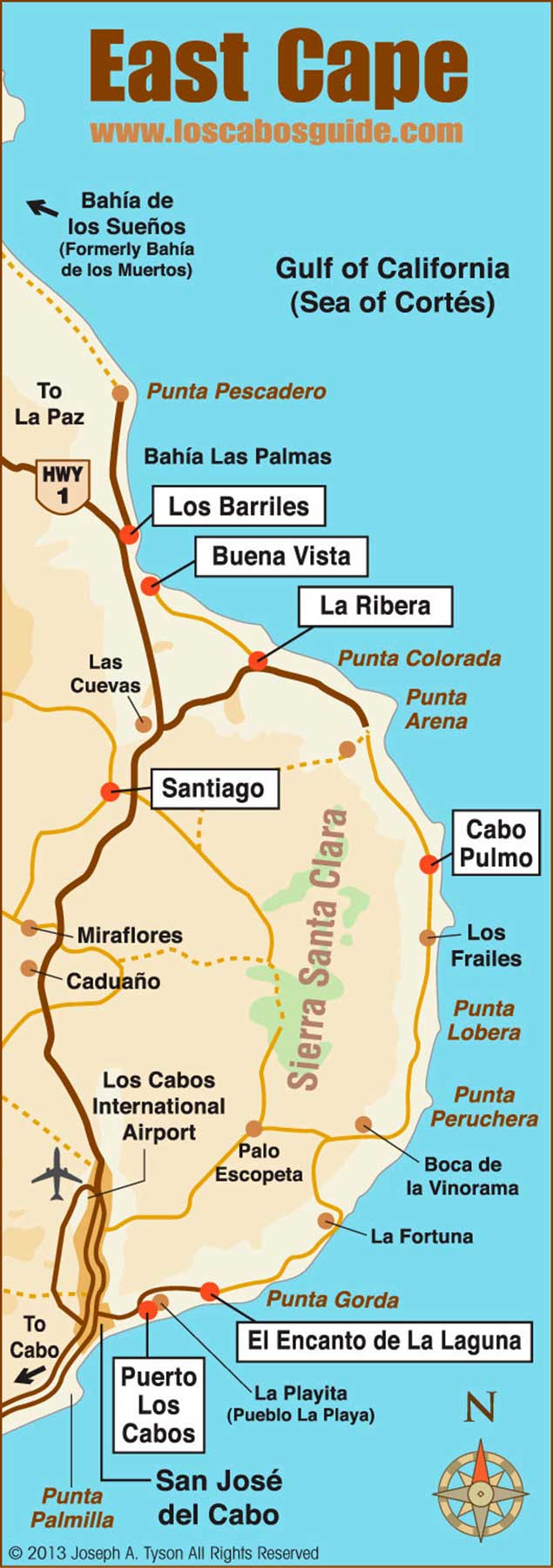
East Cape Map, Los Cabos, Baja California Sur, México
East Cape Map – The rustic East Cape region of Los Cabos stretches from Puerto Los Cabos (just north of San Jose del Cabo) north through the Cabo Pulmo and Los Barriles. Turn to this detailed Los Cabos Guide map of the East Cape to see which routes to follow and which sites to visit.
Descending from La Paz to the south, by the long route to Los Cabos (Via San Bartolo- San Antonio) at 120 kilometers, and at the other end, 60 kilometers north of San Jose del Cabo you reach the Tourist Corridor of Cabo del Este.
This East Cape Tourist Corridor is comprised of a wide coastline facing the sea of Cortes, in which the Bays of Las Palmas, Punta Pescadero, Los Frailes, La Ribera, Cabo Pulmo and Punta Colorada stand out, where important infrastructure has developed in recent years Hotel and services that has allowed the growth of populations such as Los Barriles and Buena Vista among others.
The main attraction of the area is the sport fishing, so it is internationally recognized as the Marlin World Capital. With a fleet of over 200 boats, species such as the golden marlin, Gallo fish, Swordfish and Vela fish, are coveted prey in the season from May to October. In addition to great seaside resorts with all the services and variable prices, gradually the area becomes more relevant, which is reflected by the new tourism projects that are being developed there.
In addition to enjoying the mildness of a region with low population density, the practice of recreational activities such as windsurfing, diving, kite flying, kayaking, mountain biking, horseback riding, hiking, bird watching and flora and novel fishing In Kayak, are part of the recreational activities that complement your stay in East Cape.
East Cape Map